See the below comment letter from Susan Marsh, author and Forest Service veteran.
ATT: Snow King Mountain Resort On-mountain Improvements Project
To USFS officials
Thanks for the opportunity to comment on the proposed MDP for Snow King. The outcome of the analysis to follow has the potential to greatly change the resort and surrounding town. I’ve listed issues to specific parts of the scoping document/NOI and have put any quotes from those documents in italics to make this easier to read.
Susan Marsh
Box 2115 Jackson WY 83001
smarsh@wyoming.com
General issues:
- I find that the scoping document does not agree with the December 2017 Snow King MDP, so there might be some proposed projects that have not been scoped. For example, the scoping letter doesn’t mention a mid-mountain facility at the top of Rafferty which is proposed in the MDP, and I would have comments on it had it been included. On the other hand, the scoping document goes into some detail about a proposed yurt camp on the back side of the mountain, a proposal which has been denied in the past and which, according to the 12/17 MDP, is no longer being proposed. I kept my comments about it in this response, just in case.
These are only a couple of several inconsistencies I found between the scoping letter and the MDP. Starting on August 28, I have sent three emails to the BTNF asking for clarification, and have received no replies, so I will respond to what is being scoped, whether or not it is actually being proposed by Snow King.
- I’m concerned about the overall level of development in terms of changing the character of the mountain, pricing people out, contributing to existing problems with noise, light pollution, employee housing, traffic, parking, and transportation in town, and enough ground disturbance to create a bed for more invasion of weeds. I urge that alternatives be developed that include more modest and appropriate levels of development for the national forest part of the resort, in accordance with FSM 4323.11(3) which directs the encouragement of “additional seasonal or year-round recreation opportunities that connect visitors to the natural environment that may range from active to passive recreation, natural and cultural resource interpretation and conservation education.”
- The 2014 MDP submitted by Snow King included these facilities to be placed on private land: five zip lines traversing the lower mountain; a bike skills/downhill bike park near the ice rink; the “soaring eagle” zip line (this must be the one that Snow King started building in 2012 without seeking approval from the town); and two guest services buildings (one of which is the constructed Rafferty Building). In the 2017 MDP they have either been abandoned or moved onto national forest land. If the mountain base is meant to be the most active and intensely built zone, these facilities belong there.
- FSM 2343.11 states, “Work with holders to ensure that ski areas provide a high-quality recreation experience and that recreation activities at ski areas are conducted in a manner that protects the natural environment and cultural resources and enhances community values.
- The proposal seems to intrude on the natural environment rather than protecting it. A better alternative to the proposed new road is to abandon the proposed 16’ wide road idea, reduce the grading and excavation proposed for the face and to reduce the size of the structures on top. The existing road could be upgraded to serve smaller structures on top.
- Regarding cultural resources, I found no mention in the scoping document of the fact that Snow King is eligible for the national register of historic places. Most of the buildings that contribute to this status will be removed under the proposal and the view of the area from town and beyond will be greatly altered. How will the history be preserved, interpreted, and made available so the public can appreciate it?
- I don’t see how the proposal enhances community values by greatly expanding snowmaking and lighting, both of which would further disrupt the nearby community with an increase in light pollution, noise, and an expanded “Snow King cloud” on inversion days which keeps neighborhoods cold, out of the morning sun, and the streets more icy. There would be more days during which those of us with passive or active solar heat would be affected. Community values could also be diminished by the proposal on many fronts, including increased traffic and congestion, further intrusion into a popular city park, and reduction of opportunities to enjoy the national forest in and near the resort. For instance, I no longer enjoy hiking the upper Hagen Highway due to the presence of the ropes course that goes right over it. The quiet trail setting is gone. This is also where the horseback rides used to go, no longer offered. That activity was authentic and took people into the national forest at a pace allowing them to appreciate it. It reflected the character of Jackson Hole far more than the rides and “adventures” that have been installed or proposed in its place.
Comments related to the P&N statement and preliminary issues listed in the NOI
Purposes of the proposed action:
To provide new and innovative forms of year-round outdoor recreation using the existing resort infrastructure as the hub.
Comment: I am unsure what is meant by innovative. What I see proposed are the same cookie-cutter bike parks and thrill rides that every other ski area is building. How do these relate to the character of Snow King and Jackson Hole? How do they encourage people to appreciate the natural environment and national forests?
Needs:
General comment: The “needs” in the NOI don’t show the reader the gap between existing and desired condition; like much of the scoping document, the boosterish tone reads as if taken right out of Snow King’s promotional material. What are the national forest objectives for this resort and its surroundings? How can the resort help meet those objectives in a way it doesn’t now?
- Improve and increase beginner and intermediate ski terrain, lifts, and facilities to serve as the primary ski resort in Jackson, WY to introduce and recruit new skiers to the sport.
Comment: Snow King has always been (and distinguished itself as) a steep, challenging ski area; this is why it was historically used for ski jumping and racing practice, with the bunny hills at the base. If the resort wanted to recruit new skiers and give them a place to practice, it wouldn’t have compromised existing gentler terrain with summer-oriented “adventures” like the roller coaster, new buildings, alpine slide, mini-golf and maze, nor would it be building condos and planning more, leaving the base area ever-more restricted for beginning skiers and family-oriented activities like the tube park.
- Expand snowmaking on the mountain to enable an early November opening for ski race training, provide coverage to the upper mountain, and aid in fire prevention.
Comment: A November opening depends less on snowmaking than on temperatures that allow the equipment to be used. Our late falls and warming winter temperatures call into question the value of this investment. How will snowmaking equipment aid in fire prevention, when fires are likely to occur in summer?
- Introduce high-quality guest service facilities to attract and retain local and destination skiers, serve as an event venue, and provide an outdoor education center for Jackson residents and visitors.
Comment: This sounds fine, but some of the facilities proposed don’t meet FSM direction. An outdoor education center would be great but I saw nothing about it in the proposed action. The 2014 MDP submitted by Snow King did include an outdoor education center at the base, meant to provide “graphics, handouts and instructional opportunities in wilderness preservation, sustainable environments, forestry, and animal habitats.” Nothing similar appears in the scoping document. The 2017 MDP mentions outdoor education in passing, with little in the way of specifics.
- Provide access to a wide range of year-round activities catering to a variety of visitors passing through the Town of Jackson.
Comment: Doesn’t Snow King already do this? What’s the need for change?
Preliminary issues:
The scoping letter lists the following ‘issues’ – potential effects on watershed resources, local plant and animal species, scenic integrity, socioeconomics, and other recreational use.
Comment: These aren’t issues, but categories under which some issues may fall. Impacts to the neighboring town aren’t mentioned at all, and that seems like the main concern for a lot of people.
Proposed Action: Overall issues and concerns
Comment: I am concerned that the proposal as it now stands conflicts with FSM 4314, which states that year-round recreation activities and associated facilities must:
a. Not change the primary purpose of the ski area to other than snow sports
Issue: Already summer use is greater than winter use; the addition of many of the proposed facilities brings up a question as to the resort’s primary purpose. For example, the size and capacity of the gondola greatly exceeds what is needed for transporting skiers. Has the addition of the roller coaster not met its objective to help fund winter activities?
b. Encourage outdoor recreation and enjoyment of nature and provide natural resource-based recreation opportunities
Issue: Some of the proposed facilities are either unrelated to enjoying nature (the 70-mph zip line) or unrelated to public recreation (the bar/lounge/restaurant and wedding venue).
c. To the extent practicable, be located within the portions of the ski area that are developed or that will be developed pursuant to the master development plan
Issue: Under the proposed action the development footprint will increase. The MDP describes four zones, but according to the scoping letter and maps they all will be quite developed and intensely used.
d. Not exceed the level of development for snow sports and be consistent with the zoning established in the applicable master development plan;
Issue: many parts of the proposal exceed the development level needed for snow sports; zone 4 in the MDP will include developed skiing on the back side, with new lifts, groomed runs, teaching terrain, and snow making. Zone 4 also includes new runs on the east side of the existing permit boundary. Summer developments in zone 4 include a large bike ‘zone.’ Are all these consistent with the definition of zone 4 as a relatively remote and quiet setting?
e. To the extent practicable, harmonize with the natural environment of the site where they would be located by:
(1) Being visually consistent with or subordinate to the ski area’s existing facilities, vegetation and landscape and
(2) Not requiring significant modifications to topography to facilitate construction or operations;
Issue: It appears that the proposed road will be impossible to mitigate for items (1) and (2) above. As proposed, the 16-foot wide face road requiring extensive cuts (90 feet of disturbance) on 35-40 degree slopes will permanently alter the vegetation, terrain, and scenery and would actually interfere with use of existing terrain for skiing. Also of concern is the reason this road is “needed.” It would appear to have more to do with the scale of the proposed infrastructure on the summit, which is geared largely toward the non-snow season.
f. Not compromise snow sports operations or functions
Issue: The face road could very well create hazards where it crosses ski runs; even a smaller ‘cat track’ creates a sudden topographic break. It would interrupt the fall line of existing runs.
g. Increase utilization of snow sports facilities and not require extensive new support facilities, such as parking lots, restaurants, and lifts.
Issue: Though no parking is proposed on national forest lands, new restaurants etc. and lifts are.
Project-specific issues and concerns, following sequence of proposals from the scoping letter.
A new ski school/teaching center on the ridgeline west of the Snow King summit.
Issues with this proposal:
- The ski school is not located at the resort base where it can be easily accessed without riding a lift and where ski rentals and other support items are now available. The new Rafferty building at the base houses the ski school now; I assume it was built for this purpose and serves it well, so I don’t see the need for another one at the top. Though use of the runs from Rafferty Lift has been compromised by the roller coaster, there is still plenty of good terrain at the base for beginning skiers to learn.
- Riding the lift will add to total time spent for a lesson or to use beginner terrain at the summit. Some can’t do it, like the school kids who have less than an hour to ski as part of their PE program.
- Wind and weather are likely to be more of a factor in whether the ski school will be able to open or stay open on stormy days than if the school were placed at the base.
- Cutting glades into the forested area in the beginner/ski school terrain will reduce habitat now used by warblers, tanagers, and grouse. Along with other proposed openings along the ridge, there could be overall degradation of this habitat and displacement of wildlife that some people go there to see.
Development of skiing in the natural bowl on the back side, south of the Snow King summit.
Issues with this proposal:
- The snow quality and quantity is marginal on this exposure, even with snowmaking. This is a poor choice for skiable terrain and with warming winters will become even more so.
- The snowmaking expansion planned to allow skiing in this marginal snow area could have effects on spring runoff in Leeks Canyon and negatively affect viability of nesting habitat for sooty grouse and migration routes for deer and elk between Cache Creek and the low-snow frontal mountains south of Snow King. Man-made snow tends to be more compacted and melt more slowly than real snow and may persist well into May.
- The noise of the latest snow making equipment is already a nuisance to townspeople. What will be the effect of taking it farther up the mountain to access the summit? Will this be a disturbance to wildlife as well?
- Will adding much more human activity, including night skiing at the summit, have a negative consequence for migrating birds or wintering wildlife? Many migratory birds fly over Snow King to gain elevation and some, like hawks and sandhill cranes, migrate into November and arrive back in the valley in mid-March. Will the lights disturb migrating birds as they do in so many other places? Will lights be shaded so they don’t shine upward, attracting birds?
A 67-acre special use permit boundary adjustment on the front side, east of the existing permit area.
Issues with this proposal:
- The 2012 Comprehensive Plan, adopted by the Town Council and County Board of Commissioners, states that “no new planned resorts should be created, and existing planned resorts should be limited to their existing footprint.” The proposed permit boundary expansion runs counter to this guidance.
This permit expansion is largely meant to accommodate the proposed new face road to construct, access and service proposed summit facilities. Issues that pertain to both road and new ski runs:
- The cut/fill slopes needed for the new road will be a scenic blight and will invite the spread of weeds. Alternatives exist: reduce the size and extent of summit facilities so something smaller in the way of a road can service them, improve the existing road which will remain in place anyway, and consider use of Leeks Canyon, which is already being used by those servicing communications towers.
- The forest east of the permit area is a known nesting area for forest raptors. We know of nesting territories for northern goshawks, Cooper’s hawks, and redtail hawks. The area has already been impacted by the existing new lift and ropes course—what will the additional effect be? Have any nesting surveys been done, before or since the new lift and ropes course were constructed?
- This area offers year-round security and thermal cover for elk, deer, and moose. It is also used by elk to reach snow-free areas to the south. Displacement of animals already stressed during winter may occur.
- I question the need for expanding the permit boundary into this area simply to allow the construction of a road. The ski runs shown on the map accompanying the scoping document are short and inconsequential (though the MDP shows more ski runs above, not included in the scoping document). An alternative would be to keep the area boundary as is and issue a Class D road permit if the road is truly needed in this location.
- Ski run 4 and the road switchback appear to be in the path of Ferrin’s Slide. I don’t see a benefit to deliberately placing these facilities in a known avalanche path and then requiring new avalanche control where none is needed now.
- The geologic information we have about the mountain east of the resort indicates the presence of landslide hazards. Cutting into this slope for road building could oversteepen and destabilize it. Snowmaking could increase the amount of water delivered to this currently low-snow slope, thus increasing risk of slides.
An 89-acre special use permit boundary adjustment on the front side, west of the existing permit area.
Issues with this proposal: similar to those above, along with:
- Winter range closures for wildlife security exist nearby, and the forested slope is used by elk, deer, and moose (as well as their predators). Displacement of animals can be expected with glade skiing and the presence of more people in a currently little-used area.
- Illegal winter use of closures is a continuing problem already, so won’t expanding the resort to the west add to this problem? How will the permittee prevent winter range poaching in places like Josie’s Ridge?
- If the only proposed new facilities on the west side are the teaching center and access road, why is there a need to expand the ski area boundary into the large forested area below the road? As with the requested permit boundary expansion on the east side, it appears that the area sought exceeds any need. If the BTNF retained management of this slope it is more likely that important fuels reduction projects could continue. *Note—the MDP does include a new uphill bike trail, but the scoping letter does not.
New ski terrain totaling about 97.5 acres (groomed runs and teaching terrain).
Issues with this proposal:
- It appears that new runs on the face will reduce the only forested area between the existing major ski runs. That patch offers some refuge for birds and other wildlife, which will likely be displaced with the construction these runs.
- Wind could be a major factor in the utility of the back side runs and teaching terrain, both in terms of foul weather for skiers and the use of the gondola, which could be shut down in wind.
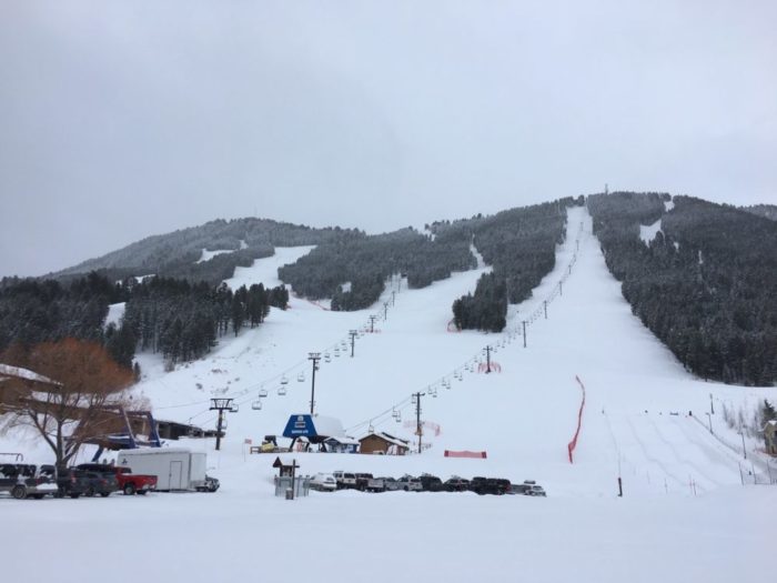
Upgrading the existing Summit lift to a gondola, and installation of one new chairlift, two teaching area conveyors, and one surface lift.
Issues with this proposal:
- The location of the base for this facility impacts Phil Baux park. Work with the town to move the terminus uphill.
- According to FSM 2343.14(1g), screening proposals for additional facilities includes the direction that “new activities and associated facilities must increase utilization of snow sports facilities and not require extensive new support facilities, such as parking lots, restaurants, and lifts.” The gondola is essentially a lift replacement, but the chair and T bar and carpet lifts on the back side comprise considerable new development, not to mention the ski school and other associated support facilities. Less is better on the summit.
- What are the plans for skier safety if the gondola is closed due to weather and people are stranded on top taking a ski lesson? How will they get down?
- What is the need for a lift capable of transporting 1200-2400 people per hour, when skier numbers are a small fraction of that? Is a smaller gondola or tramway a possibility? Or a quad chair with state of the art safety restraints?
On-mountain facilities (the summit restaurant/guest services building and ski patrol facility, a temporary ski patrol building at the top of Cougar, an observatory and planetarium at the summit, a wedding venue west of the summit building, and a year-round yurt camp at the southern point of the special use permit area).
Issues with this proposal:
- New structures on the summit are best consolidated into a small footprint confined to places already impacted by past construction, to avoid sprawl and changing the setting from a quiet, semi-developed area to a hub of activity. There is already a hub at the base. I compare what is planned at Snow King on public land to what exists at the far-more developed Jackson Hole. Mid-mountain facilities notwithstanding, there is little to take away from people’s enjoyment of views once they ride the tram to the top. The snack bar at Corbet’s Cabin is appropriate for the setting. A 25,000 square foot complex on top of Snow King, to be open at night with a restaurant, bar and lounge, is not. An alternative to this proposal is to restore or replace the existing Panorama House with a similar footprint. This was planned during the 2013-14 period when the snowmaking expansion was approved, but the idea has since disappeared, along with a number of other agreements between the resort and the Forest Service.
- Though the new structure is to be one level, it’s likely to be seen from elsewhere, its lights in particular. There are county regulations prohibiting “skylining” of homes and other structures, and though they are not rigorously enforced, it would seem inappropriate to allow a national forest permittee to violate them.
- The restaurant/guest services facility as described in the scoping letter seems quite incompatible with a national forest setting, particularly on a mountain top where sewer, water and other utilities are made more complicated by distance from the base. The 15,000 square foot building I heard about during public meetings is now 25,000. What seems appropriate to me for a mountain summit is a small and simple food service-shelter, not a full-scale, high-end business that includes a bar, lounge, and other “guest services” that are best offered at the base. FSM 2340.3 states that the forest should deny proposals by the private sector to construct or provide outdoor recreation facilities and services on National Forest System lands if these facilities and services are reasonably available or could be provided elsewhere in the general vicinity. Restaurants, bars, meeting spaces and so on belong at the base (where they already are).
- The scoping letter states that the proposed summit facilities would “take Snow King to a new level in terms of guest services and experience.” This sounds like promotional material from the resort. What national forest objective would be met by taking the resort to a new level, i.e. high-end? My concern about this is that Snow King will price out locals and people with modest means. This is public land and people should not be turned away because they can’t afford it. Even the proposed observatory, which could be an asset to all, would require people to pay to ride a lift.
- I don’t buy the argument that “changing desires and expectations of community and regional markets” necessitate placing at the mountain summit so many of the standard services and structures typically found at the base of ski areas. As far as I can tell, the expectations of the community haven’t been considered.
- In regard to the “temporary” ski patrol building at the top of Cougar, what is meant by temporary? A building sounds permanent. If this is meant to be moved at some point, where?
- (FSM 4314.6 says “Allow temporary activities that rely on existing facilities, such as concerts or weddings, even if they are not necessarily interdependent with a National Forest setting, provided they are enhanced by it. Do not authorize new permanent facilities solely for these activities.” The in-ground wedding venue structure proposed, which is in my opinion poorly located relative to the other facilities on top, is contrary to this direction.
- With the amount of surface disturbance proposed for the summit area, what will be done to survey for native plants and then protect what is found? Has a survey been completed?
- I’m concerned about the need for extensive grading and vegetation removal for ski school facilities. One of the attractions along the existing nature trail/Josie’s Ridge connector is the stand of mature aspens.
- Is SKMR aware of the NRCS snow course? (I assume the answer is no since they mowed a considerable amount of sagebrush both in and out of the permit boundary to host the 2017 solar eclipse.) From the map provided with the scoping document it appears that the proposed ski school and other facilities might also impact this site. Perhaps the snow course is no longer used, but it would be good to check with NRCS.
- There is no mention in the scoping letter of a mid-mountain “guest service” building, yet the 2017 MDP calls for one (page 8): “Construct two new guest service buildings on USFS lands, one at the summit of Snow King Mountain, and one at the Rafferty Mid-Mountain area.” Why is this proposal omitted from the scoping letter? And why are these services now being requested for placement on public land when the 2014 MDP placed them at the base?
In regard to the possibly proposed yurt park and ADA trail, several issues arise.
While the scoping letter and map 4 described the yurt camp and access in detail, the 2017 MDP states that (page 45) “This facility is no longer planned as a component of the MDP.” In case the scoping document is correct and the 12/17 MDP is not, I have the following issues to consider.
- This facility would be located in important wildlife habitat that is now undisturbed, with human trails bypassing it. Having cooking facilities and so on would likely lead to the presence of attractants for bears. This past spring a grizzly bear made his way from Game Creek to Cache Creek on a route that is near this proposed site.
- Year-round use would disrupt wildlife movement, elk calving, and bird nesting.
- I find it interesting that the trail to the yurt is the only facility specifically described in the scoping letter as ADA-compliant. I assume that everything else will be as well. The fact that it is brought up here makes me wonder: what is meant by an ADA-compliant trail? It could be four feet wide and covered with rolled shredded bark. Or it could be wider, and paved, thus also serving as a service road for resort vehicles, not compatible with the MDP zoing. The nature of this trail will have much to do with its potential impacts.
- The scoping document claims that “This [yurt] facility would be unique in the region due to the ease of access, spectacular setting in the National Forest, and number of activities offered.” Maybe that’s true these days, since other resorts including Togwotee Mountain Lodge no longer do yurt trips because of low public demand. So this seems like a somewhat iffy venture. Assuming the environmental concerns that led the BTNF to nix this proposal in the first place no longer exist, an alternative would be to experiment, with no permanent structures, to determine how popular it would be.
147.1 acres of added snowmaking (with few exceptions, all existing and proposed runs).
Issues with this proposal:
- Currently, noise from snowmaking comes right through our closed windows and the machines run all night. This disturbance to neighbors will only increase with additional snowmaking. It could be mitigated by shutting off the machines for a few hours at night but I have asked for that before and received no reply. Another mitigation would be for SKMR to purchase less noisy machines than the ones in use now, and for the BTNF to require this as a condition. Also, don’t let them install a bunch more of the bright yellow machines that stay in place all year. They are an eyesore.
- How much water is all this snowmaking going to use and will it have an effect on the new town wells and water system we now pay higher rates to fund?
- How much increased power will be needed, and will higher capacity transmission facilities be needed? (This is not a fantasy. Lower Valley installed new power lines over Teton Pass because of increased demand, as they said, “from high-end resorts and large houses.”
- What is planned if it becomes too warm for snowmaking – as it has been lately, especially in the late fall? If the goal is to revive the racing venue in November, is snowmaking possible when it doesn’t always freeze at night? No amount of snowmaking is going to change the climate trend or improve the breakable crust that is typical of the back side.
- Snowmaking proposed for the east side permit boundary expansion and the back side of the mountain would negatively affect wildlife wintering habitat and movement.
- I’m concerned that increased snowmaking, especially in places prone to landslides, will create instability during the melting period in spring.
Improved and expanded lighting for night skiing.
Issues with this proposal:
- This is another concern about increased power use, described above. National forests and the resorts that operate within them should be exemplary in reducing their carbon footprint.
- Light pollution is a serious problem, and currently the night-skiing lights are sometimes left on later than agreed to. Unwanted light can be mitigated if the lights are shaded so they shine onto the snow rather than in everyone’s face. Also the impact on night-migrating birds would be reduced. Requiring the retrofitting of existing on-mountain lights, as well as requiring new ones to be shaded, would be a great thing for the FS to do.
Front-side mountain bike trails and a back-side mountain bike zone.
Issues with this proposal: The proposal calls for a dense and extensive trail system that involves most of the existing permit area. I have the following questions and concerns about it.
- Are any of the proposed trails intended to be multi-use? If not, hikers who currently hike the existing Snow King trails daily will be displaced from an area they have been using for decades.
- Map 4 accompanying the scoping letter doesn’t show the proposed uphill bike trail on the requested boundary expansion to the west of the resort. The 2017 MDP (fig 9) shows a densely packed set of switchbacks going to the top of the mountain. Bringing year-round use into this currently quiet area will displace what wildlife remains around Snow King.
- Which of the existing trails on the Snow King face will be retained, and how will junctions with the proposed bike trails be managed to promote safety? A map of existing facilities at the resort, along with locations of non-resort installations such as the snow course, would be very helpful to the reader trying to see the difference between existing and desired condition.
- It appears from the map that the lower beginner/intermediate bike trails will be “excavated” and will consist of a dense series of switchbacks. How will these be constructed to minimize their effects on scenery, vegetation, and bare ground exposure? It’s not clear what is meant by excavated but since the word is contrasted with hand-built trails I guess we can assume they will be built by bobcat or mini dozer. Concerns I raised already about the road cuts and associated disturbance to soil and vegetation would also apply here. This large amount of disturbance is another invitation to weeds.
- The back side mountain bike “zone” is incompatible with the purported objective for the yurt installation, to allow people to experience a quasi-backcountry setting. It is unlikely to provide that illusion in close proximity to a bike park with the associated shouting, infrastructure, etc.
- How is the backside bike zone going to affect use on off-resort trails? The proposed bike zone includes the entire Zone 4 area on the back side and will take in existing multi-use trails maintained by the BTNF. The FS calls its trails multi-use while the resort continues to refer to all of them as bike trails, so it’s clear how they will be promoted. Hikers are already being displaced from heavy-use trails in Cache Creek and the horseback riders have all but given up. The BTNF specifically stated when the Skyline Trail was built that it would not become a bike-only trail accessed from and advertised by Snow King. I’m not sure from this proposal how that’s going to happen.
- I’m not sure I buy the argument made in the scoping letter in regard to forest health and fire hazard—are the patches to be cleared for ski runs large enough to make a difference at the landscape scale? If glading and tree removal are part of a 2015 vegetation management plan already in place, does it take the adoption of the new MDP to begin implementation? I haven’t seen much being done so far within the ski area boundary. I wonder if it’s time to relook at the vegetation management plan both in and adjacent to the area to see if the BTNF, Snow King, and the private property owners can work together for an integrated fuel reduction project that also considers the needs of wildlife.
- “Features” I assume mean constructed jumps and skills challenges; to what extent does concentration on the next feature detract one from enjoying, or even noticing, the national forest through which you ride? I suggest keeping the feature trails toward the base of the hill (as per 2014 MDP) instead of having this activity spread throughout the forested patches farther up. This way the use is concentrated into a more active zone, leaving the upper mountain somewhat more peaceful.
Hiking trail between the summit and the west base, west of Exhibition run.
Issues with this proposal:
- Most hikers will tell you there is nothing more boring than a set of switchbacks through thick trees. It appears that this proposed trail was tossed into the mix to show that the planned trail system is not just for bikers. (This is another place where the maps provided in the scoping letter differ from what is in the 2017 MDP.) There are unrealized opportunities to enhance hiking, passive uses, and nature study in the existing permit area, were it not all focused on biking.
- New trails in this currently little-used part of the area could displace what wildlife remains, without offering a particularly attractive option for hikers.
A zip line from the summit to the west base area, paralleling the Summit lift.
Issues with this proposal:
- SAOREA and FSM 2343 direct that activities are to be natural resource-based and encourage further exploration of Forest Service lands, in contrast to theme or amusement parks. How a 70-mph zip line meets that direction is hard to imagine. Zip lines that go more slowly, through trees, and have braking systems so people can actually experience where they are comprise a different story. Snow King already has a zip line as part of the ropes course and it seems more along the lines of what the drafters of the act had in mind. The zip line proposed is nothing more than a thrill ride/money-maker.
- This facility does not meet the purpose and need expressed in the scoping letter. Snow King has said publically that the purpose of the zip line is to bring in revenue. This raises a question about resort viability: Snow King claims it needs to bring in revenue from thrill-ride summer facilities like the zip line and roller coaster, in order to pay for winter sports. Given that, how much more will winter use be compromised by the addition of more thrill rides? If the roller coaster is already bringing in revenue, how much more is needed?
- The lower terminus of the zip line, along with that of the gondola, will increase the existing noise and carnival atmosphere at the base area. I can think of no acceptable alternative for the kind of zip line being proposed, but as mentioned elsewhere the gondola landing should not affect Phil Baux Park.
- 70 MPH does not strike me as a safe speed, however well the structure is designed. The recent recall of seatbelts on the roller coaster is a good reminder that dangerous facilities shouldn’t be authorized on the national forest.
- The 2017 MDP (fig. 5a) shows another proposed fall line zip line starting at the forest boundary and ending near the swimming pool at the hotel. From the MDP text and figures 5 and 5a it’s actually hard to tell what is being proposed, as some are described as ‘alternatives.’ In any case, it sounds as if the resort will offer plenty of zip lines without this proposal.